Smartmicro | Drone Altimeter T132
smartmicro Drone Altimeter (UMRR-11 Type 132): 76–77 GHz radar altimeter for small UAVs, up to 175 m, 274 g, DroneCAN, plug-and-play with PX4 and ArduPilot.
smartmicro Drone Altimeter (UMRR-11 Type 132): 76–77 GHz radar altimeter for small UAVs, up to 175 m, 274 g, DroneCAN, plug-and-play with PX4 and ArduPilot.
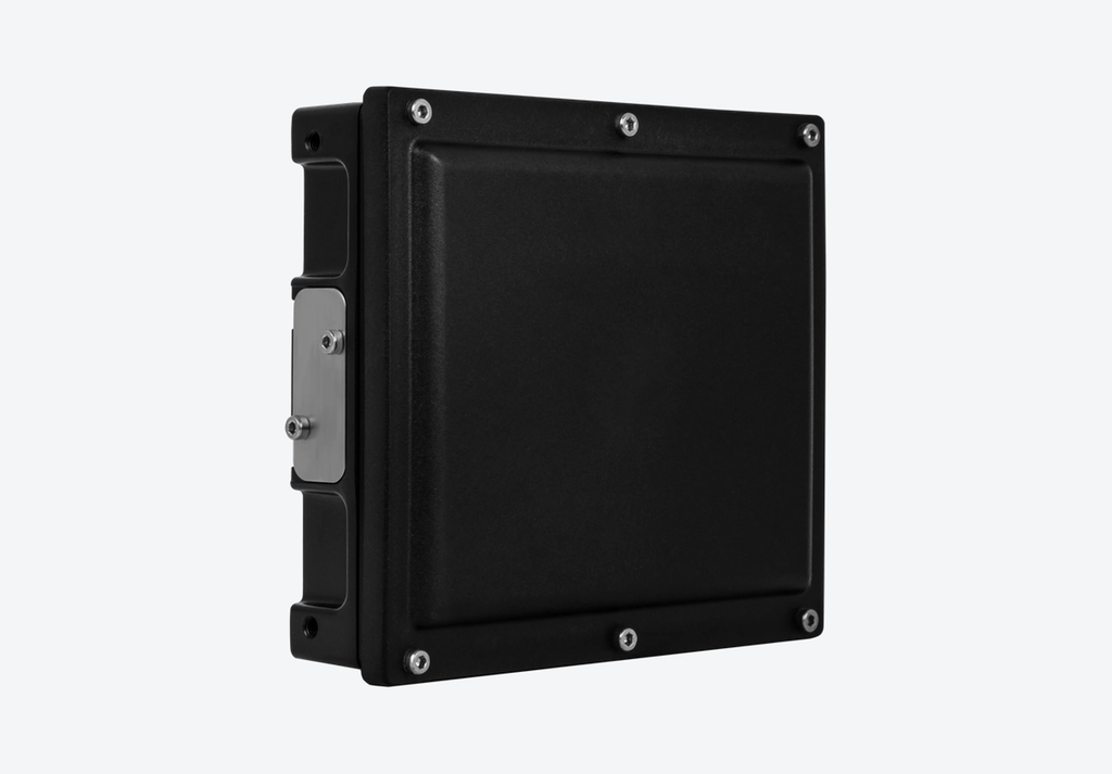
smartmicro Drone Altimeter (UMRR-11 Type 132): 76–77 GHz radar altimeter for small UAVs, up to 175 m, 274 g, DroneCAN, plug-and-play with PX4 and ArduPilot.
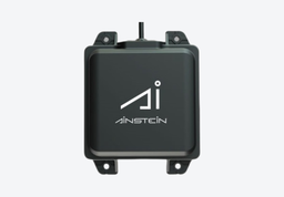
The smartmicro Drone Altimeter (UMRR-11 Type 132) is a 76–77 GHz radar altimeter for small UAVs. It measures true height above ground up to 175 m, switches automatically between a long-range and a medium-range mode, and works plug-and-play with PX4 and ArduPilot autopilots over DroneCAN.
At 274 g and 3.75–5 W it suits tight SWaP budgets. The IP67 housing is rated for -40 to +85 °C, and the sensor can be mounted inside the fuselage behind a flat, radar-transparent plastic panel. It is made in Germany, ITAR-free and available in high volume for series production.
Measures 1.0 to 175 m in long-range mode and 0.5 to 64 m in medium-range mode
Automatic mode selection for consistent altitude between 2 and 175 m
DroneCAN over CAN 2.0B at 1 Mbit/s, plug-and-play with PX4 and ArduPilot
274 g, 94.7 × 84.4 × 26.4 mm and 3.75–5 W for SWaP-constrained drones
Reliable in fog, dust and darkness and over water, where optical and barometric sensors struggle
IP67, -40 to +85 °C, 100 grms shock and 14 grms vibration
Made in Germany, ITAR-free, in the 76–77 GHz band approved in Europe
Typical applications of the Drone Altimeter include:
Industrial UAVs for inspection and survey
Small UAVs and MAVs with tight weight budgets
Precision landing, hover hold and terrain following
Flight in GNSS-denied or low-visibility conditions
Helicopters and fixed-wing aircraft needing low-level altitude awareness
For series projects smartmicro can adapt the sensor, for example:
Housing, connectors and weight optimisation
Conformal integration into the aircraft
Additional Ethernet or RS485 interfaces and protocols
Adjustable altitude and speed limits, frequency agility and duty-cycle optimisation
Raw radar data output and maximum altitude extended to 500 m
It communicates over CAN 2.0B at 1 Mbit/s using the DroneCAN protocol, appears as a range finder, and works plug-and-play with PX4 and ArduPilot based systems. Altitude is sent every 55 ms, 18.2 times per second.
With the black radome facing down and parallel to the ground in normal flight, and the TOP arrow pointing along or against the direction of flight. It can sit behind flat, radar-transparent plastic, but carbon, epoxy resin or metal will block the signal. The reading is perpendicular to the radome, so the autopilot should correct it for pitch and roll.
The Drone Altimeter is part of the Radar Altimeters range at Leo Drive. Browse all autonomous vehicle sensors and components, or talk to our engineering team about integration in your project.
Tell us about your platform and our engineers will propose the right setup and quote it.
 18 products
 10 products
 4 products
 10 products
 15 products
 16 products
 5 products
 5 products
 26 products
 6 products
 11 products
 5 products
 4 products
 31 products
 9 products
 7 products
 7 products
 9 products
 6 products
 1 product
 3 products
 3 products